Here is a document that will explain...
How to....
Getting
a license :
After sofware installing, click on
its icon and...
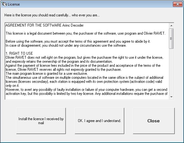
Click on "OK,
I agree and I understand."
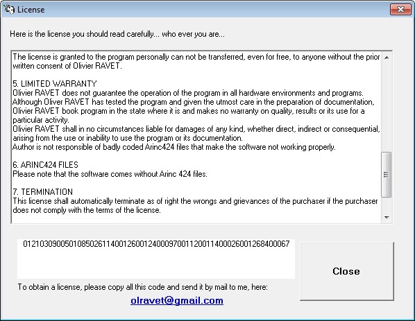
Copy + Paste the
code in a mail for me. Or click in the blue link, then send the mail.
In return I'll send a license file
(if I received 400 €, an imediate full and perpetual license, else a limited
few days trial license)
Open Arinc Decoder
Click on "Install the license
I received by mail"
Browse to catch the AD.lic file.
Switch off the software, reload it,
and everything should work... exept if you are in trial version, some functions
will be disabled.
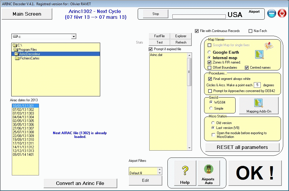
After,
when you just installed ArincDecoder and your license is valid... You get this:
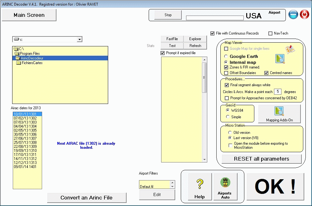
Push on the button
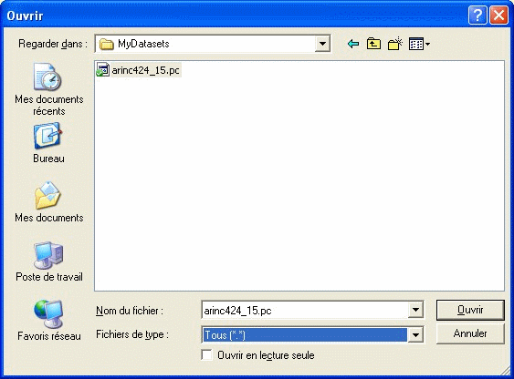
to open your dataset Arinc.
Select it...
This will create one file named "Arinc.dat".
This one:
(Note, if the file is a CIFP file from FAA, it will have a name ArinUYYMM, this
to permitt to have 2 files of the same cycle on the same PC.)
Select it...
and the file is inspected and rename
Program will show:
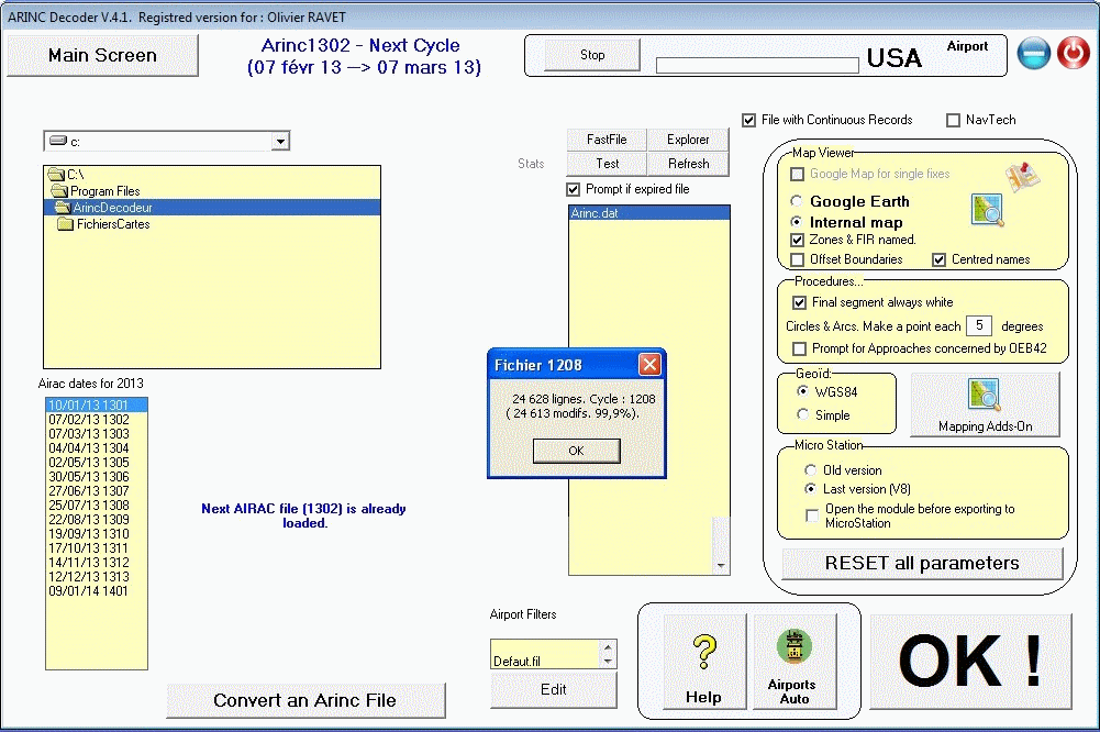
Close the message box and the file
will be in the list by the name of its cycle:
It's time to view what's in your
file...
Click on "Airways"
and "Europa"
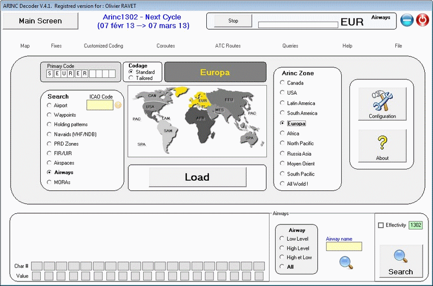
Click

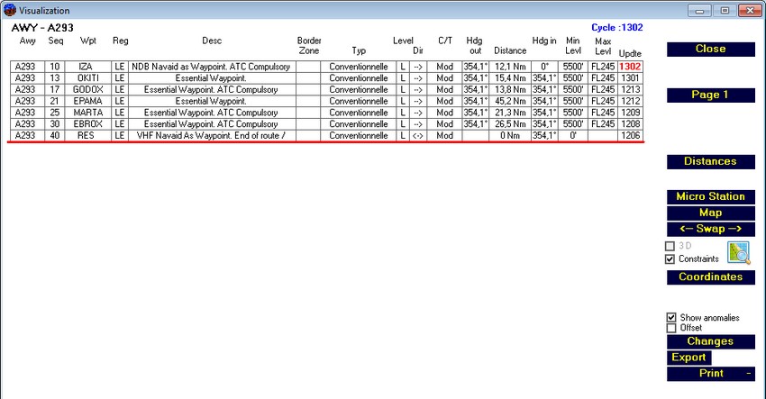
And select an airway in the list...
Example A293 and this window will
show:
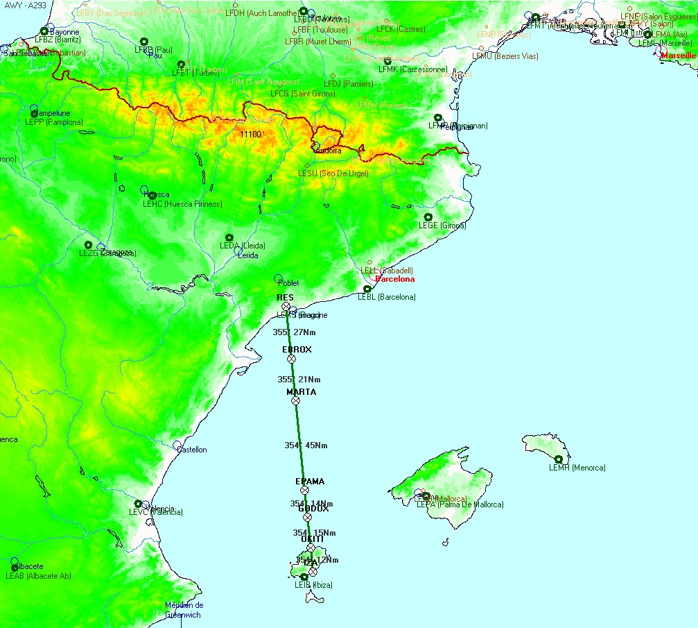
Pressing the button of the map, you'll
plot it:
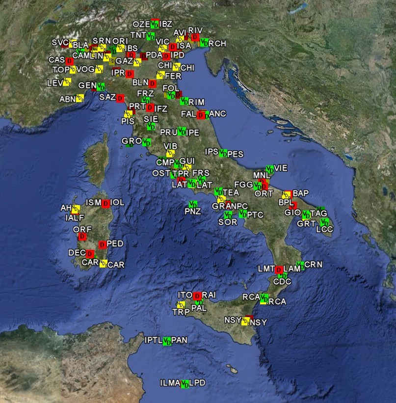
Click on "Navaids"
and enter (in the green circle) "LI" to obtain all the Navaids of
the region "LI" (Italy !!!)
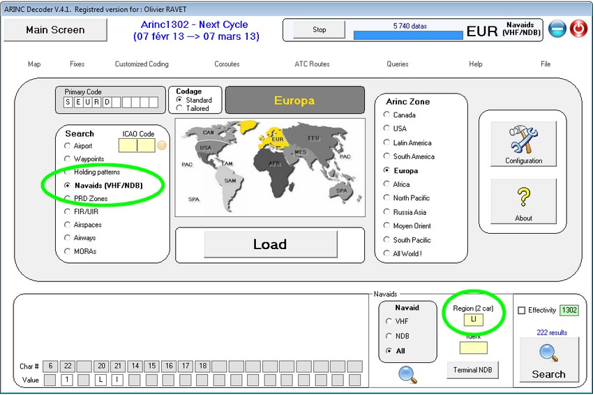
All they come (222)
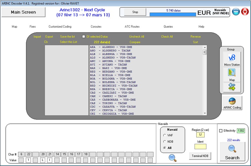
Press on
and hop hop hop...
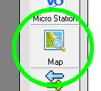
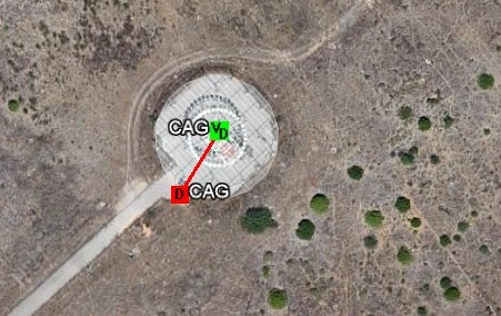
Push on 
to switch from this map to google
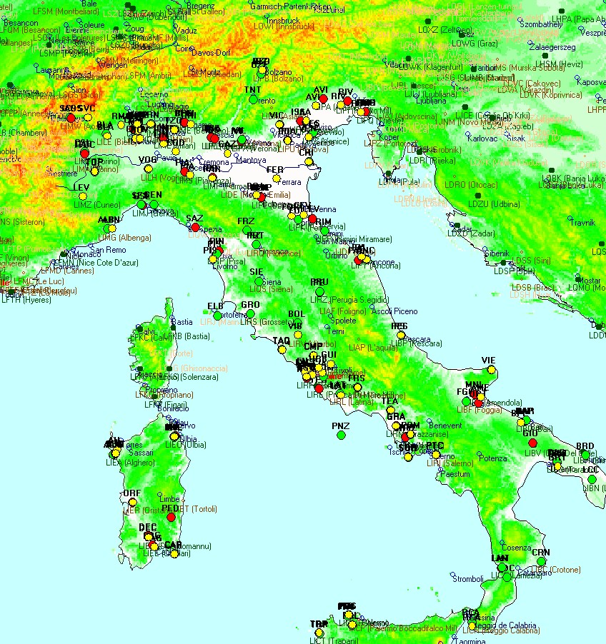
earth (if you have it) and... will
show...
will
show...
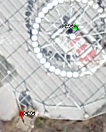
To get info on an element click on
it... example, Vor-Dme of Cagliari
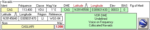
The VOR is not exactly co-implanted
with the DME...(Latitude / Longitude for the DME are written in red font)
Press on the 2 compass
(by the top) above the latitudes boxes.
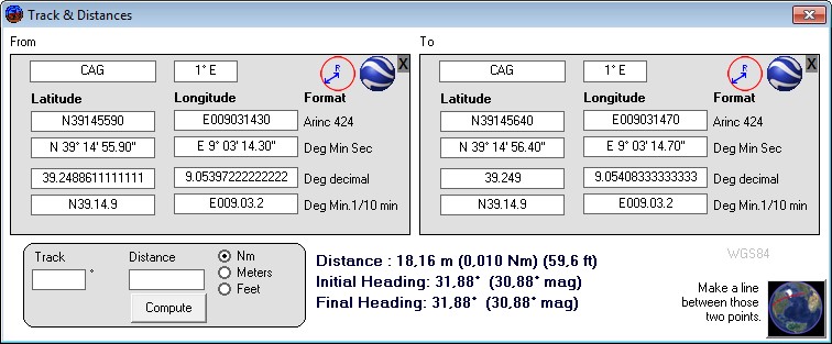
You'll see that precisaly 18.16 meters
exists between both antennas...
That's an example.
If your file has
airports information:
You want to know... it's an other
example... how you can reach the Airport of Hakodate (HKD RJCH) in north of
japan.
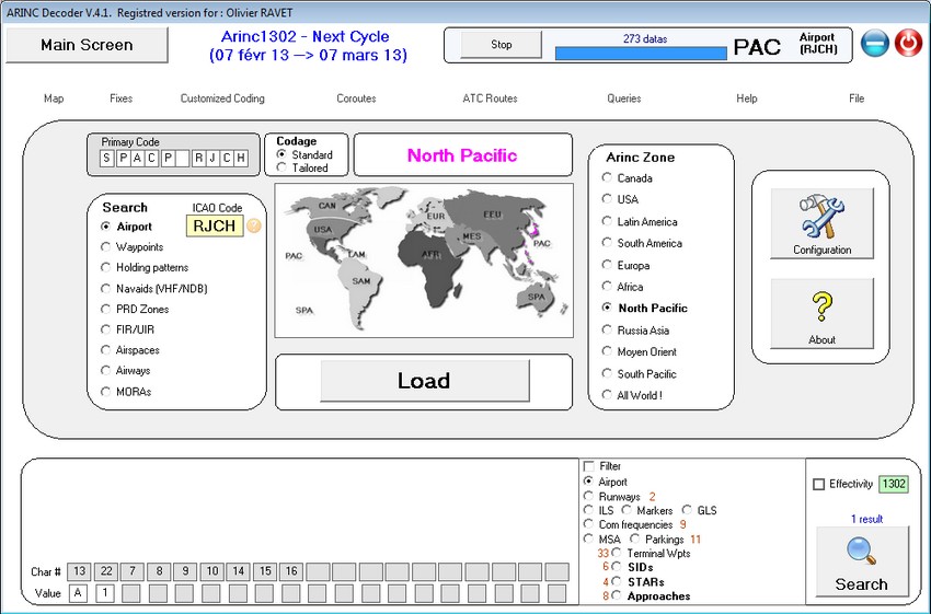
"Load" will give
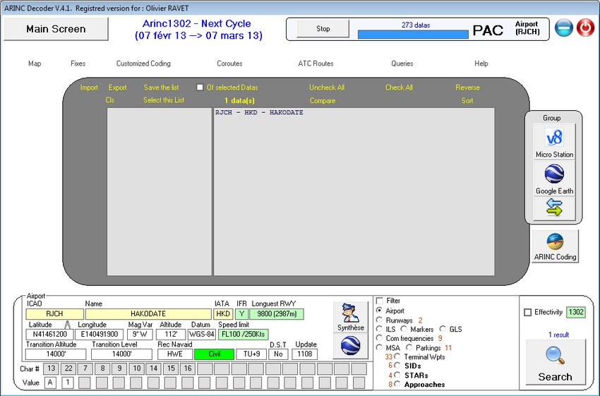
And you see that you will find there:
- 2 runways
- 9 Communication frequency
- 33 terminal waypoints
- 6 Sids (departures)
- 4 Stars (Arrivals)
- 8 instrument approaches
- and 11 parking stands.
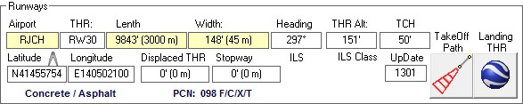
Clic on "Runways" then

you'll get that:
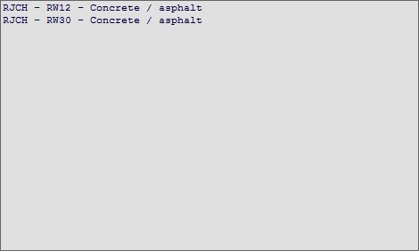
with informations relevants:
You want to see the
approaches available there:
(same clic on "Approches"
then ...)
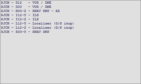
Select wich one you want to see:
RNAV 30 zulu, Autorization requested...
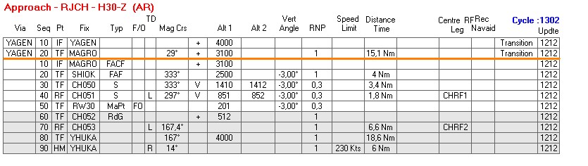
Press on the button looking like
a map and you'll have below, the calculated vertical profile, and all parameters
collected for computations.
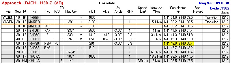
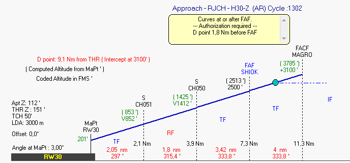
All values are calculated with datas
in the database
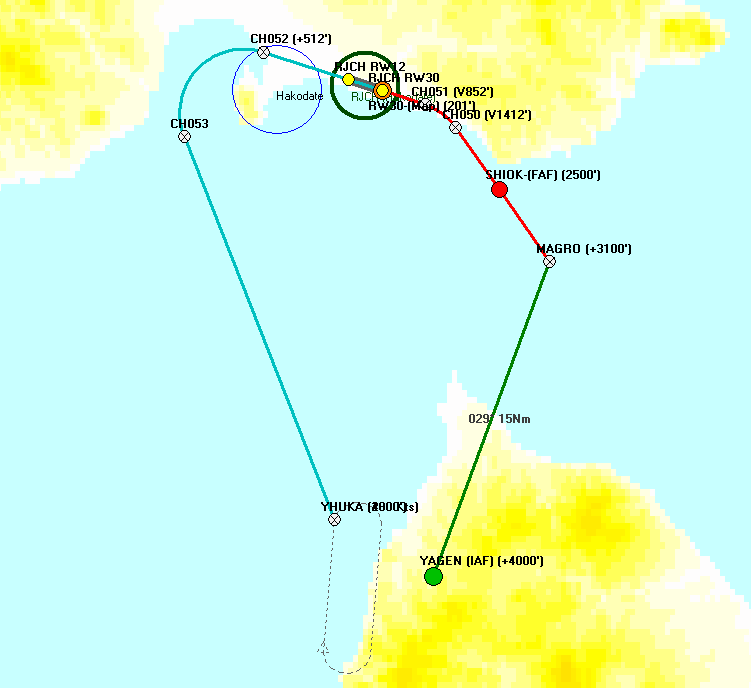
The map is shown in a new window
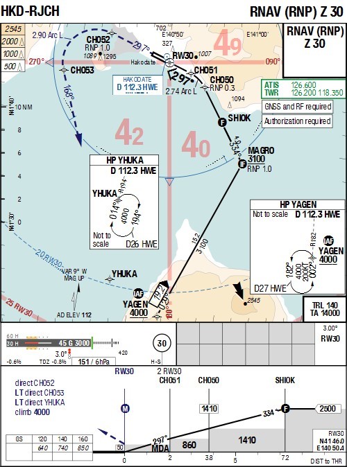
The published map of the same procedure:
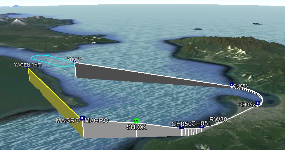
And just for the eyes... with google
earth...
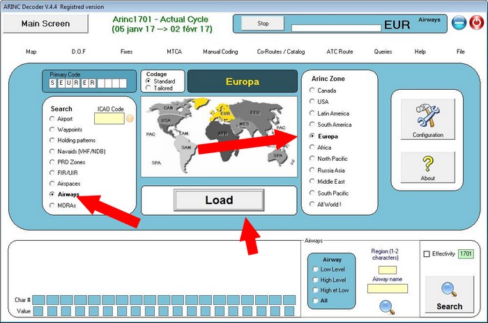
Visualizing
the changes between two cycles...
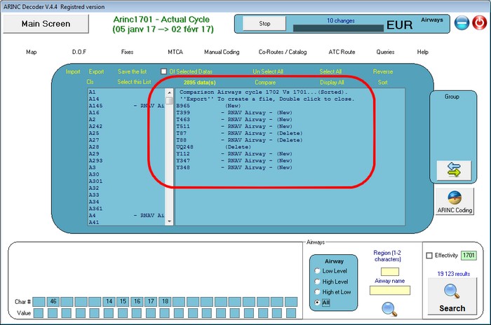
Despite the fact we have the checkbox
"Effectivity" to see only the changes of the current cycle, with this
you don't see the objects that are deleted, and you see all minor changes.
With this option you will see very
quickly what is new and what is deleted...
In the reference cycle, you plot
what you need, where you need:
Example for the airways, in Europe
!
When the list is done you press on
"Compare" then the cycle you want to compare...
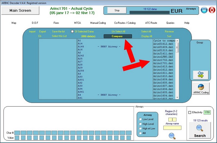
Few seconds after, you have the listing
of the changes in new and deletes...
Back
to ArincDecoder.